Tutorial: Keyhole Markup Language (KML) File Convert in Different Format
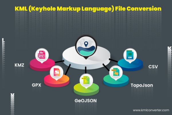
KML viewer and converter are used on the map to convert your file into KMZ, GPX, GeoJSON, TopoJSON, and CSV with ease. When KML files are displayed in maps,

What is KML File?
KML (Keyhole Markup Language) is an XML-based format for geospatial data. Geographic Information System (GIS) applications can open files saved as KML if they support it. KML file format support has become widespread in applications since it was made an international standard. KML makes use of nested elements and attributes in a tag-based structure. All of the tags are case-sensitive, and it's crucial to use the KML Reference's recommended order.
A Brief History:
KML was initially created for use with Keyhole Earth Viewer, the predecessor to Google Earth. The Open Geospatial Consortium designated KLM as an international standard in 2008. The format has the distinction of being the first to view and edit KML files because it was created for use with Google Earth. With time, more and more projects, including a number of APIs written in various languages, have emerged that support KML file formats.
KML, or Keyhole Markup Language, stands for. The KML file format was initially created by Keyhole Inc. for the Keyhole mapping software. In 2004, Google purchased the Keyhole business and its software. Although other mapping programs have been known to use this file format as well, the Google Earth application is currently the main application to use KML files.
Information about geographic modeling is stored in KML files using an XML format. These files include polygons, points, lines, and pictures. They are used to create overlay textures, camera angles, and location labels for the maps made by the mapping applications.
What is KML viewer and converter?
KML viewer and converter are used on the map to convert your file into KMZ, GPX, GeoJSON, TopoJSON, and CSV with ease. When KML files are displayed in maps, it causes a lot of people problems and is very frustrating. Your KML file can be loaded into a KML viewer and converter and converted quickly into any format, including KMZ, GPX, GeoJSON, TopoJSON, and CSV. You can view and convert files using this app for free.
How does it work?
The KML viewer and converter tool is readily available and converts your file quickly. The simple steps listed below explain how to use the KML viewer and converter.
1) Import your KML file from Dropbox or else in your google drive.
2) In this step, many of your KML file and here you choose any one KML file
3) When you choose your file here, you can see an instant preview of what it will look like.
4) To convert the file, choose your format. KML to KMZ, GPX, Geojson, Topojson, CSV, or KML choose any one format.
5) Now click on share and your work is done.
Other Converters
Convert KML to KMZ
Convert KML to GPX
Convert KML to GeoJson
Convert KML to TopoJson
Convert KML to CSV
KMZ File
A representation of a zipped KML file that contains geospatial data viewable in GIS programs like Google Earth is a KMZ (KML Zipped) file. The file contains latitude and longitude information for placemarks along with a custom name. Users can easily share the single packaged KMZ file with one another. KMZ files can also contain data from 3D models for the purpose of georepresenting the model. By saving the KMZ file to an online location and then entering the URL in the Google Maps search box, a KMZ file can be opened in Google Maps.
| Read Also: Best Land Survey Calculator for Android & iPhone
GPX File
The GPS Exchange format is used by files with the GPX extension to exchange GPS data between online applications and web services. It is a compact XML file format that can be read and imported by a variety of programs and contains GPS data, such as waypoints, routes, and tracks. The GPX file format is open and accepted by a wide range of software and GPS units. Geospatial purposes can be served by loading GPS data from such files for display on mapping applications.
GeoJson File
Using non-spatial attributes to represent geographical features, GeoJSON is a JSON-based format. This format describes various JSON (JavaScript Object Notation) objects as well as how they can be joined. The information about geographical features, their spatial extents, and their properties is collectively represented in JSON format. This file's objects can be a geometry (Point, LineString, or Polygon), a feature, or a group of features. Addresses and locations are represented as point streets, and major thoroughfares and international borders are shown as lines. Nations, provinces, and land regions are shown as polygons. Different mobile routing and navigation applications can specify the coverage of their services using GeoJSON. TopoJSON is a smaller version of GeoJSON that also encodes geospatial topology.
TopoJson File
Geospatial topology is encoded in a TopoJSON file format, a geoJSON format extension. Geospatial data and attribute data are both included in TopoJSON files (arcs). Arcs can be referenced multiple times by various shapes within the file, greatly reducing data redundancy and the size of TopoJSON files. Arcs are sequences of points that can be used to define line strings and polygons. The use of arcs in this format distinguishes it from other GIS formats. Frequently, software like Microsoft PowerBI uses this format.
CSV File
A list of data is contained in a plain text file called a Comma Separated Values (CSV) file. These files are frequently used to transfer data between programmes. CSV files are frequently supported by databases and contact managers, for instance.
Posted 3 years ago by Rathod Khyati


